This blog describes my planning before the walk and the walk itself, which took place over 5 days in late September 2025 and will hopefully provide some useful hints for future walkers. The blogs I read before the walk about other people’s experiences were invaluable.
Why I did the Walk
Although I was raised in Northumberland, living either in Hexham or nearby villages until I left school, and had visited the various forts, I had never actually walked any section of the wall, but it was always in the back of my mind to do it. However, it was the tragic death of my sister and my determination that something positive had to come from such a terrible situation that set me on the path to ‘Hadrian’s Wall Walk for Sky’ – a walk both in memory of my sister and to raise money for two charities that I know would be very close to her heart. Here is a short chat to camera that I did on Day 2 of the walk.
About me
I’m 58 years old, hover around 98kg (15st 6lbs) like a beer when I can (I’m a train driver, so that is not very often), partial to fast food but reasonably fit-ish. My previous walking experience amounted to walking up Ben Nevis, Helvellyn and also Conival in the NW Highlands, but that was about 20 years ago. I certainly hadn’t done anything on the scale of the 75 miles between Carlisle and Wallsend – not Bowness to Wallsend for reasons I’ll explain shortly.
Prep for the Walk
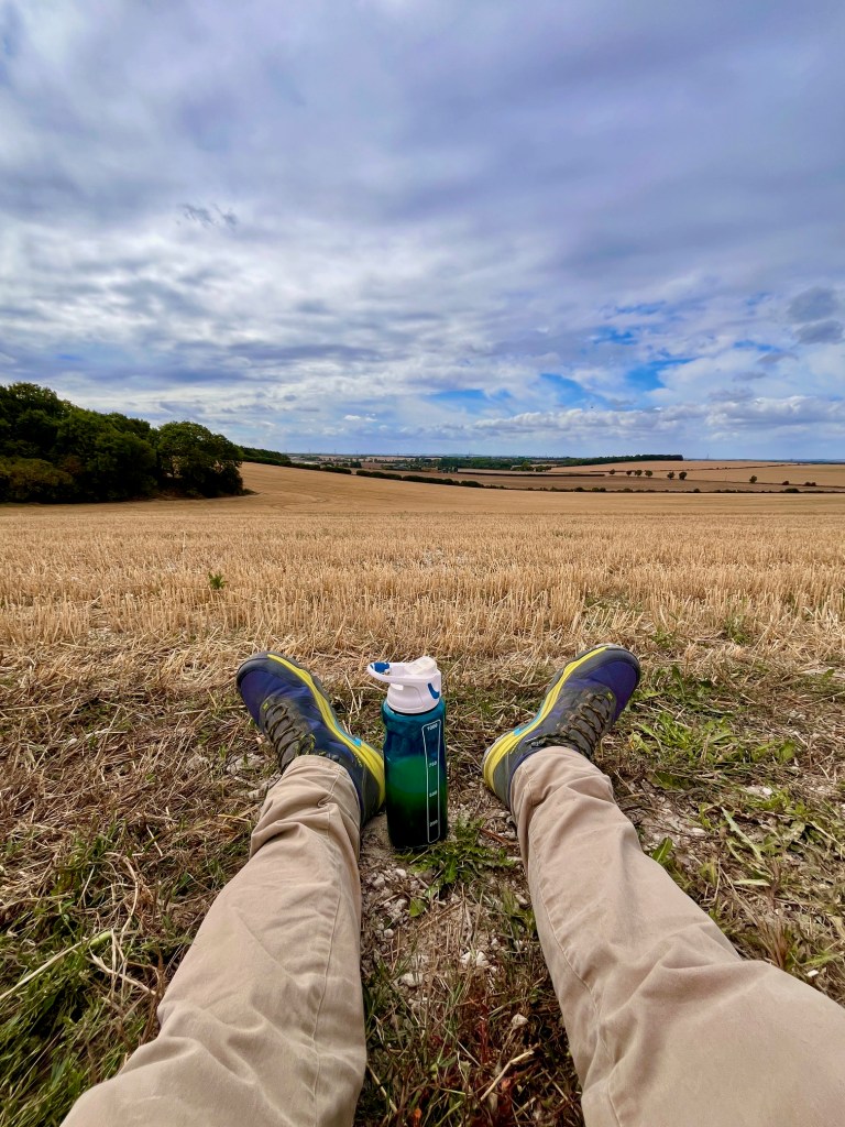
As I hadn’t done any serious walking for a couple of decades, I knew I had to do a fair bit of training. I had some Meindl boots, which I had bought around 2003, which were still in excellent condition, but were pretty heavy, so I made the decision to invest in a new pair. In the end, after looking at several review sites, I bought a pair of Helly Hansen (Men’s Ascender Mid Helly Waterproof) boots, which came in at around £180. These were about a third lighter than my Miendl boots, and they ended up being a very sound purchase.
My sister died in late April and by June I had made the decision to do the walk during my September leave period. Looking back, I can see that I joined the ‘Hadrian’s Wall Walk’ Facebook Group in June (an excellent resource), although I didn’t really do any training until mid to late July – so I had just over two months to get reasonably fit.
I can see, looking back at my notes, that I also looked at sunset times, as I didn’t want to be caught out in the dark while still up on the wall. In late September, the sunset times are around 7pm, so I aimed to finish each day around 6pm, which gave me a bit of breathing space for the unexpected, poor weather, etc.
My training consisted of building up from 5 mile walks to a maximum of 18 miles. I wanted to walk further than on any day of the actual walk. Initially, these would be completed in a single day, with a rest day in between. As I got closer to the actual walk, I would do longer walks of 10+ miles on consecutive days. Unfortunately, living in the pretty flat county of Bedfordshire, I couldn’t mimic the numerous ‘ups and downs’ that I would experience on the walk itself.

Part way through my training, I started carrying weights in my backpack – up to 7KGs – we didn’t have any more weights in the house! This was definitely one of my better ideas, as it matched what I was carrying on the hardest days of the walk, which were days two and three.
Logistics
I spent a considerable amount of time working out how to do this walk. I was slightly time limited and, as I don’t do camping, on a budget for accommodation as well. I gave myself 5 days to complete the Carlisle to Wallsend section. I omitted the Bowness to Carlisle section for a couple of reasons. The first was to save on the cost of an extra night’s stay and if I was going to miss out a section, there was no other option really than to miss out this one. Purists may argue that you have to do the whole thing, and I must admit the lack of completeness irked me for a while, but I soon got over it.
I also decided very early on to go from West to East. Hopefully, to have the wind behind me and also to finish in Newcastle, where my sister and nephew lived and where my wife and some friends would meet me at the end of the walk. As it happened, we had very little wind over the five days, and remarkably not a drop of rain.
I found it quite difficult to get consistent distances for each section of the walk, as different guides gave different distances, and this made deciding the daily sections a little more difficult. However, in the end, after buying the Cicerone ‘Hadrian’s Wall Path’ book (which also contains a very handy 1:25,000 map booklet) and downloading the Ordnance Survey App to my mobile and logging each section, I came up with the following schedule.
Day 1 Carlisle to Lanercost – 14.3 miles (23 km) – return to Carlisle.
Day 2 Lanercost to Once Brewed – 16.1 miles (26km) – stay at Milecastle Inn.
Day 3 Once Brewed to Chollerford – 13.0 miles (21km) – stay in Hexham.
Day 4 Chollerford to Heddon-on-the-Wall – 15.9 miles (26km) – stay in Hexham.
Day 5 Heddon-on-the-Wall to Wallsend – 16.1 miles (26km) – stay in Newcastle.
Total 75.4 miles (121km).
I stayed in Carlisle for two nights (before the start of the walk and after Day 1) at the Carlisle Station hotel (£164 total), then I stayed one night at the Milecastle Inn (£114 total), followed by two nights in Hexham at my friend’s mum’s house (no charge!) and then in the Dorset Arms in Wallsend for two nights (£156 total). This chopped and changed a bit as the kind offer to stay in Hexham meant I could alter the original booking I had there, which was at the Station Inn for three nights (total £165), to one night for my nephew.
I booked the Milecastle Inn just a few days before the walk – and this proved to be a good decision as that was a wonderful haven at the end of what was a beautiful, but absolutely exhausting day. If I had booked all the above a bit earlier (and also didn’t have the kind offer of staying in Hexham), I would have booked all the places more on the route itself rather than having to do a fair bit of travelling getting to and from the end/start points each day.
The last mile of each day is always considerably harder than the first mile! Do take this into account when planning your route – and depending on where you are staying, it is a must to add on the walking mileage from the path itself to wherever you are going to – and do the same for getting back to the path the next day.
I had stayed in Sunderland on the weekend before the walk and after meeting my friend and his wife in the Centurion Bar at Newcastle Central station to catch up and drop off my bag, which would end up at Hexham, I took the train from Newcastle to Carlisle. The length of this journey, as the train trundled towards Carlisle, gave me a mildly daunting sense of just how far I was going to walk over the next five days.
Day 1 Carlisle to Lanercost – 14.3 miles – Ascent 656 ft Descent 566 ft
The previous evening was spent in the local Wetherspoons. No beer, but a very nice burger and an early night. I could hear the station announcements, “see it, say it, sort it,” through my open window, which reminded me of work, but I soon drifted off to sleep after getting my backpack ready for the next day.
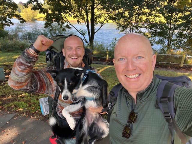
After meeting my nephew Ben, a seasoned walker, who was to do the whole walk with me (along with his untireable dog Zeus), we started off on a beautiful, crisp morning at about 10.30 am. The first day is pretty flat, with only 656 feet of elevation and a similar amount of descent. However, it is a lovely introduction to the walk. You do not see any section of the wall itself – that comes on Day 2 – but you are walking along the route of the wall at times. Fairly soon into the walk, you will cross the M6 motorway and that will be the last of any very busy roads you will see or hear for some time.
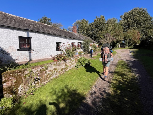
You do travel through some lovely villages and you will pass several honesty boxes, with soft drinks and chocolate on offer. These boxes are a very welcome feature of this end of the walk; they seemed to disappear as we ventured East.
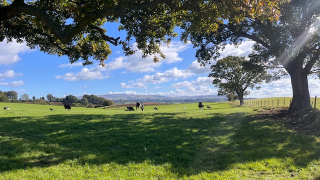
Unsurprisingly, there are a lot of cows and sheep on the route and the occasional horse. I’d read some stories about cows forming up in line and being rather intimidating, but we never really had any issues, although when a herd of cows stubbornly refused to move away from a stile, I had to rather unceremoniously navigate a wall and ended up knee deep in nettles.
As my nephew was camping, we parted company about an hour before the end. He hit the jackpot and managed to find an ‘honesty bar’ where he had a few pints of ale (somewhere in Walton) and I experienced the first moderate hill walking up to Haytongate, where I stopped at an excellent honesty booth (on the left through a gap in the trees) before walking down to Lanercost and a taxi (I got the number from a post in the Facebook group) back to Brampton (£8) and a 685 bus back to Carlisle bus station which is in the centre of the city and a short walk from my hotel next to the railway station.

The bus stop for the bus back to Carlisle is just outside Cranston’s Food Hall and is well worth a visit if you’re hungry – I certainly was!
Overall, an excellent day. An old blister that I had acquired during the training had come back and was causing a little discomfort, but after putting on three Compeed plasters (other brands are available), this didn’t cause me any further discomfort throughout the walk.
Day 2 Lanercost to Once Brewed – 16.1 miles – Ascent 2,499 ft Descent 1,899 ft
This was a moving day, so all my kit went in the backpack today – other than the big bag that I had dropped off in Hexham, which contained ‘civvies’ and extra clothes for the later part of the walk. If I hadn’t been able to drop this gear off in Hexham, I would definitely have used the transfer services that are available to pick up/drop off gear between your lodgings.
A bus to Brampton, and then the same taxi driver from the previous evening took me back to the start point for Day 2 – and kindly drove me all the way up the hill to Haytongate, rather than drop me at Lanercost.
As my nephew was camping, he had made an early start, and was some way ahead of me. Today’s walk started with a steady uphill climb, which was a gentle taster of the hills to come! Day 2 was the day that I was most concerned about – and there were a couple of times when I thought I may have bitten off more than I could chew. However, the scenery was incredible and I made sure that I stopped and looked at the views as much as possible. When you’re struggling, it’s easy just to put your head down and miss out on what’s around you. I avoided this by pretending to take in the view – the reality is that I was exhausted!
Before I paint too daunting a picture, I should say that the first half of the walk is nothing too strenuous and you finally get to see the first part of the Wall, near Banks – a taster of what is to come.
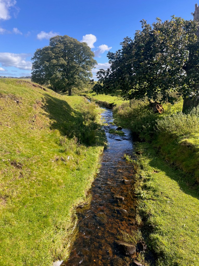
As you approach Birdoswald, you really are feeling that you are out in the middle of nowhere, and the wall is an almost constant companion. I stopped at Birdoswald for a break and something to eat and drink before crossing over the River Irthing on the approach to Gilsland.

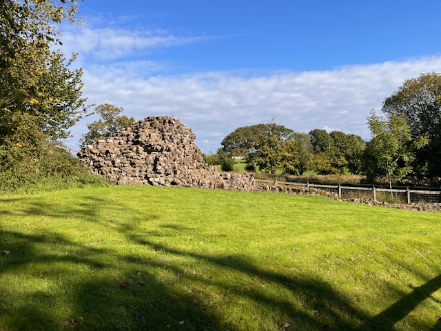
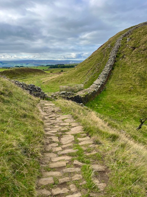
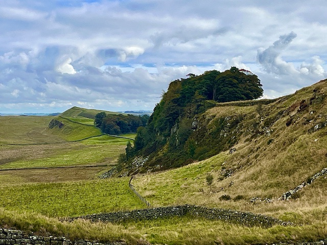
Onwards from here, you end up crossing over the Carlisle to Newcastle railway line, before passing the remains of Thirlwall Castle. This was just before the toughest hill so far. The picture below does not do it justice. This was where things started to get tough, through a combination of fatigue and gradient.
It was just after this point that I met up with my nephew again – not due to my athletic pace, but rather he’d taken an extended look around the nearby museum. It was the boost I needed and we carried on together for another hour or so, before splitting up again, as at this time his walking pace was definitely quicker than mine. We had no qualms about splitting up as people naturally have different walking paces – and we kept in touch regularly via text/calls to check how we were doing.
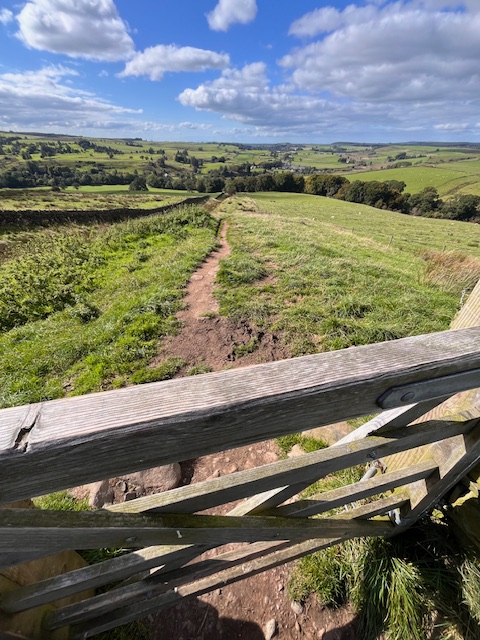
There are numerous ups and downs in this section and for me, it was a bit of a slog. I don’t think I’ve ever been so pleased to see a trig point! However, the views were spectacular as you pass along the crags of Walltown, Cawfield and Winshield. This really is the day you want good weather, and we certainly had that, with hardly a breath of wind. The late afternoon light was something special and despite my fatigue, I made sure that I soaked it all in.
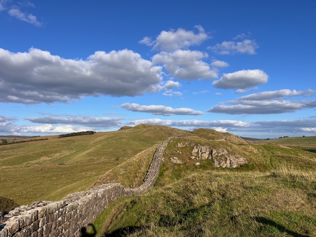
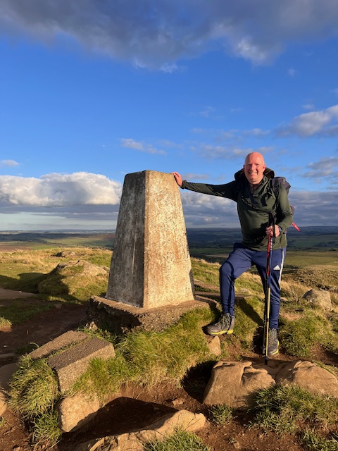

I caught up with my nephew in the ‘Twice Brewed Inn’ and enjoyed a couple of swift pints before being given a lift from Sean, a friend of Ben’s to the Milecastle Inn, where I had the best Mac ‘n Cheese ever (although I think I would have devoured raw mince with glee) and a lovely night’s sleep. For reference, the Milecastle Inn is just South of Cawfield Quarry. Earlier in the day, as I was approaching the quarry, which is before the stretch that leads up to Winshield Crags, the highest point on the walk, I had seen a sign for the Inn. I think it was about 1/2 a mile away and had to resist the temptation to cut my day slightly short, and was glad I did, as everything about the view that evening from the top of Winshield Crags was incredible. However if I was planning the walk again, this would be the place to come off the path, rather than having to double-back on myself.

Day 3 Once Brewed to Chollerford -12.9 miles – Ascent 1,403 ft Descent 1,952 ft
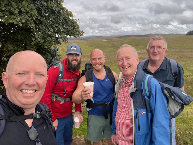
Waking up nice and refreshed and surprisingly not too achey, we (my nephew had stayed with friends in Haltwhistle) got a lift back to our previous day’s end point, just West of Peel Crags. Today we were also joined by Sean, who my nephew had met while walking the West Highland Way, and then at Housesteads by Gordon and David from Sunderland, who had come out to walk with us for the day. Their company was a real boost.
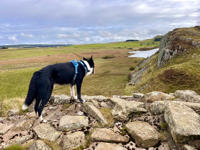
This was another day of spectacular views, right from the very beginning of the walk and also the day when we passed through Sycamore Gap. I’m pleased to say that there are lots of signs of life coming from the stump. It was another tough day of ups and downs, I gave up counting how many there were and also how many stiles we clambered over. I was definitely starting to envy Zeus’s boundless energy, but when we all met up at Housesteads, we were a happy band.
Day three fatigue was setting in and I may have been muttering a bit (ok, a lot) about how tired my legs were, but the scenery always lifted the mood and we chatted about all sorts, particularly the latest on Sunderland football club’s return to the Premier League.
The highest point on today’s walk was Sewingshields Crags and like the previous day, while you could clearly see the highest point in the distance, there were numerous ups and downs to negotiate before you got there. We had split up into two groups by then, the oldies and the youngsters, and when we reached the trig point had the knowledge that from now on it would mostly be downhill.
Once you have passed the crags, the path links up with the Military Road, which you will walk near for most of the rest of the day. We were joined by Ken at this point, who had been dropped off by the AD122 bus and had started walking Eastbound to meet us. By the time we reached Chollerford and plotted up in the George Hotel beer garden, there were some tired legs and feet, but we had all enjoyed the walk. We ended up in The Forum pub in Hexham – it used to be a cinema when I lived there (there is still a small cinema upstairs), but most of us didn’t stay out for long.
Day 4 Chollerford to Heddon – 15.9 miles – Ascent 1,323 ft Descent 1,075 ft
Once we had gathered everyone, there were four of us walking today, two Bens, Ken and me. We met up outside the train station and got the AD122 Bus back to our start point for the day at Chollerford. There is a fairly steep hill to negotiate out of Chollerford but after that it is pretty much plain sailing. While the views are not as spectacular as days two and three, and you have the Military Road close by, the scenery is still beautiful. Our first stop was at the Errington Coffee House – which used to be a pub when I went there as a teenager and it was busy on a Thursday lunchtime, which I take as a good sign. Onwards we went, and we also had another break at the Robin Hood pub for some decent pub grub.

Again, the last few miles were heavy going, nothing to do with the terrain, but accumulated fatigue, and one of the group had twisted their knee slightly, but we made it to Heddon on the Wall in time for the bus back to Hexham.
Day 5 Heddon to Wallsend – 16.1 miles – Ascent 661 ft Descent 1,019 ft
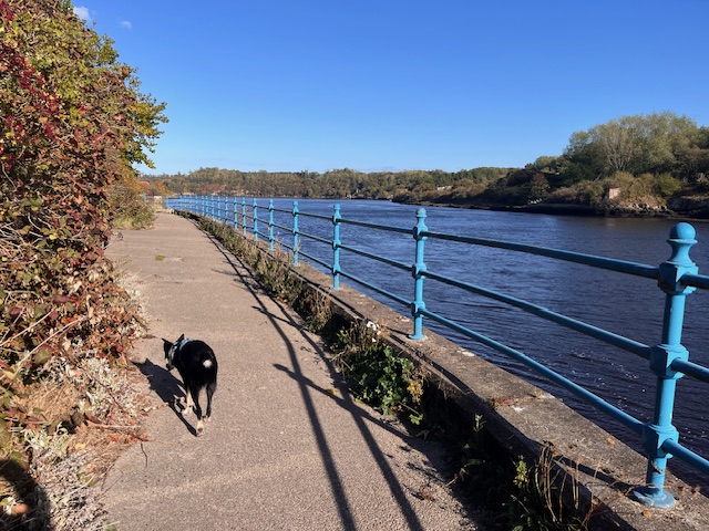
After being kindly dropped off in the morning, we started our final day of the walk in glorious sunshine and happy in the knowledge that while we had had an unforgettable experience, this was our last day! For completeness (I think you have to start or finish at Wallsend) this is a must do day, but you will not spend any time on the route of the wall itself, instead diverting down to walk alongside the River Tyne – not that this is an unpleasant thing to do and is a lot more picturesque than the actual route of the Wall which runs along Westgate Road into the city centre. There were three of us today, my nephew Ben, and my school friend Ben (Queen Elizabeth High School, Hexham), who was on his second day with us.

Once we got into the City, the Scotswood Road section seemed to go on forever and I forlornly kept looking for Newcastle’s famous bridges, which always promised to be around the next corner. However, eventually we did make it and, much like the Trig Point on Day 2, I have never been so happy to see them.

We arrived on the Quayside late afternoon on a Friday and I must admit that after five days of comparative solitude and peace, the hustle and bustle of a city centre was jarring. I wanted to reach the end, but now I was here, I had wistful thoughts of the tranquility of Winshield Crags and the beautiful stream at Gilsland. However, our journey had not yet finished and after meeting our friend Trevor on the Quayside, there were still around another five miles to go to Wallsend. After passing by the odd marina, this last section surprisingly turns quite rural in parts, with wooded banks and just the odd factory by the river as you leave the bustle of the Quayside behind.
The nearer you get to the finish line, the further away it can seem. We had some good chats about the walk, but we longed for the end after a tiring day, much of it on hard tarmac, rather than the lush grass of previous days. The Ordnance Survey was consulted frequently to answer the “how much further?” question and check the updated arrival time to make sure that we had people to meet us at the end!
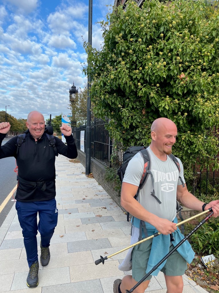
It was a great relief to finally see the distinctive viewing tower of the Segedunum museum and meet up with my wife Juliette and friends at the entrance. Unfortunately, by the time we arrived the museum was closed, but I made sure to get my final stamp of the walk, located outside the Eastern entrance to the museum.


Some of us headed straight off to the pub, while my nephew, my wife and I headed up to my sister’s old house (about three minutes from the end of the walk) and had a quick cup of tea, before getting a lift from Nikki’s friend Kirsty and checking into the Dorset Arms at the top end of Wallsend. We then headed to Ouseburn and the Donzoko Brewery and Taproom for some much needed hydration and excellent pizzas from next door’s Gingerino’s pizza restaurant, which the brewery were happy for you to eat in there and met up with some of my sister’s friends. It’s all rather hazy from this point, but a great night was had by all.
My sister taking her own life has obviously been devastating, but I am so pleased that we managed to do something so positive from it and as of today have raised over £3,000 for two charities that I know would be very close to Nikki’s heart. The walk was certainly tough, but if I can do it, I’m sure you can too. I hope you get the same weather we had – we did not have a drop of rain over the five days. You will certainly gather memories that will stay with you forever.
If you need to talk to someone, you can call the Samaritans any time on 116 123.

What next? There are many beautiful walks across the UK, I’m sure I’ll be planning my next walk in 2026 soon. Thanks for reading and many thanks to all those who supported me! If you’re about to do the walk, do let me know how you get on.
Julian Vaughan
29th October 2025
Further Reading/Useful Info
AD122 Bus Service: Runs Between Hexham and Walltown Quarry Car Park: https://www.gonortheast.co.uk/ad122
Stagecoach Bus Routes – including the 685 Carlisle to Newcastle, which I used at the end of Day 1 and start of Day 2: https://www.stagecoachbus.com/routes/cumbria-and-north-lancashire/685/carlisle-brampton/XNCO685.O
Helly Hansen Boots: https://www.hellyhansen.com/en_gb/ascender-mid-ht-12015?
Hadrian’s Wall Walk for Sky Fundraising Page: Open for donations until 25th December 2025: https://www.givewheel.com/fundraising/9181/hadrians-wall-walk-for-sky/
Streetwise Young People’s Project: https://www.streetwisenorth.org.uk/
Poets In Creative Writing Charity: https://www.poetsin.com/
Hadrian’s Wall Path by Cicerone (including 1:25,000 route map booklet) https://www.worldofbooks.com/en-gb/products/hadrian-and-039-s-wall-path-book-mark-richards-9781786311504?
Hadrian’s Wall Trail Planner Blog (2014 Walk): https://trailplanner.co.uk/england/hadrians-wall/
Walking the Hadrian’s Wall Path – an in depth guide: https://whatsdavedoing.com/hadrians-wall-guide/
